Where Eagles Dare: Hiking the Adlerweg
The Adlerweg, a 320km, 24-stage trial running the length of the Austrian Tyrol, turned 10 this year. To celebrate, OAG’s Mary Creighton went to hike a stage or two… snow permitting
“JUST 803M LEFT to climb… 802 left… 801m…” This is my mantra as we (my husband John and friends Nicky and Alex) climb up towards Solsteinhaus, high above the Inn Valley. The first half hour of the hike has not been kind to us.
Tirol Werbung
After a five-minute stroll through the woods from the train station at Hochzirl we were suddenly faced with an unrelenting sheer climb straight up the lower flanks of the Brunstkopf. No winding forest path to warm you up, just a 35 degree track which throws you straight into head-down, teeth-gritting charging mode. OK, I knew this section of the Adlerweg, Tyrol’s best-known long distance hiking track, would be steep, with over 900m of altitude gain in just 7km, but looking at contours on the maps is not quite the same as forcing one leg in front of the other, rasping breath after rasping breath.
The hike from Hochzirl to the mountain hut at Solsteinhaus is Stage 14 of the Adlerweg (Eagle Walk), a 320km hike across the Austrian Tyrol starting in the Wild Kaiser mountains in the east and ending in the Lechtaler mountains in the far west. It’s named for the shape of the route, which resembles an eagle and its outstretched wings on the map (well, with a bit of imagination anyway).
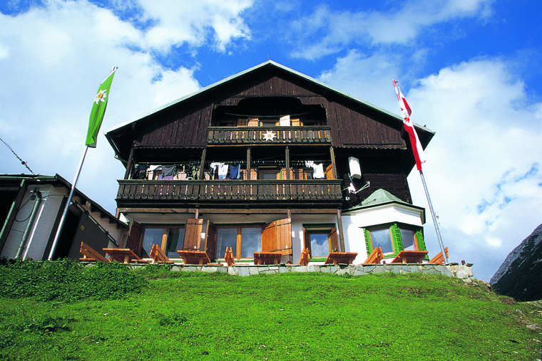
Solsteinhaus, an Alpenverein hut above Zirl | © Tirol Werbung
Since moving to the Tyrol last summer, I’d noticed it marked up on maps and even unwittingly hiked a few sections of it, but I didn’t know much about it until a press release popped into my inbox last March informing me it was it was turning 10 this year. Right, I’ll have to hike a bit of it then, I thought.
Two months later I’d chosen my route – the first section of the Adlerweg, a three day-hike from St Johann to Kufstein – booked my huts, checked trains and broken my walking boots in. But two days before we’re due to leave I open my curtains. Thick clouds and mist loom over the valley and rain thunders down onto the balcony. Then I catch a glimpse of the mountains above… they are white. Very white. Thick snow right down to 1000m. With most of our hike above the 1200m mark and our winter hiking skills limited, we have to pull the plug.
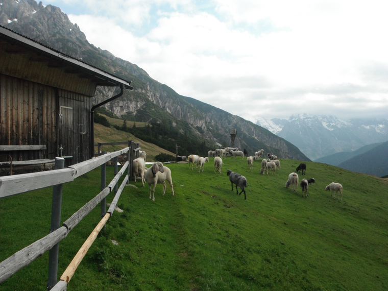
Sheep are plentiful, humans less so
A precious bank holiday weekend lost to the last vestiges of winter, we plan an overnight hike a little closer to home for the next weekend: from Innsbruck, Tyrol’s capital, up to Solsteinhaus, over the Erlspitze (2405m) and towards the German border. We spend the week nervously watching the snowline creep higher and higher. By Friday, the hut website says it’s clear of snow from all directions, and on Saturday we take the Mittenwald railway up to Hochzirl, and begin the battle up to our overnight stop at 1806m.
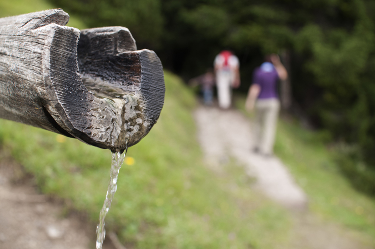
After 45 minutes, the steep 4WD track (how any car can get up there is beyond me, but deep tyre tracks suggest it’s doable) evens out to the more gradual forest track we had hoped for and a chance to enjoy the silence of the woods and peer at the limestone gorge below us. The busy Inn Valley is invisible from here, and signs of civilisation are growing thin – just the occasional chalet or farm pokes out of the woods above us.
 Soon we reach the goods lift for Solsteinhaus – a long pulley mechanism that transports food and drink from around 1500m to 1806m, keeping overnight guests very well fed, despite the lack of road access. I seriously contemplate climbing onto the platform and ringing the bell, in the hope that whoever’s up there mistakes me for a delivery of Knödel. But instead we press on and a few hundred metres later the track ends and we officially say goodbye to civilisation for the next 24 hours.
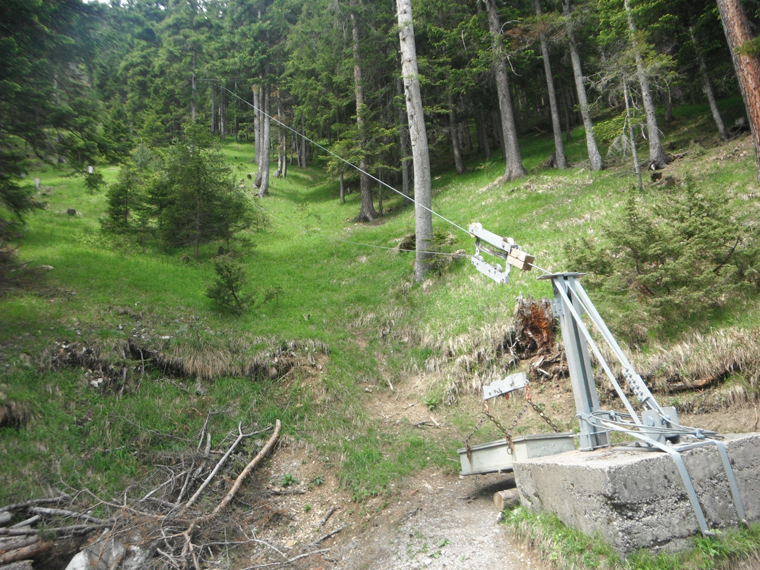
The bottom goods lift that services Solsteinhaus
Crossing over a small stream surrounded by moraine, we spot a bench and pause for a late lunch, complete with cake, candles and schnapps for Alex, who’s bravely celebrating his 29th birthday with a hearty ascent. From there the climb is steep, a narrow path etched out of rock and tree stumps, our steps getting wearier as the trees thin. We’re grateful for the red and white waymarkers painted onto trees and rocks by the Austrian Alpine Club, or we’d certainly struggle to follow the path.
We break through the treeline and reach a wide open meadow at Solnalm. The view from here is well worth the effort – below us the mountain descends sharply into the valley and beyond that is the Stubai Alps. We can just make out the lifts of Axamer Lizum ski resort, looking remarkably snowy for the last weekend of May. North of us are the limestone peaks of the Karwendel mountains, fierce and craggy and still showing signs of last week’s snowstorm.
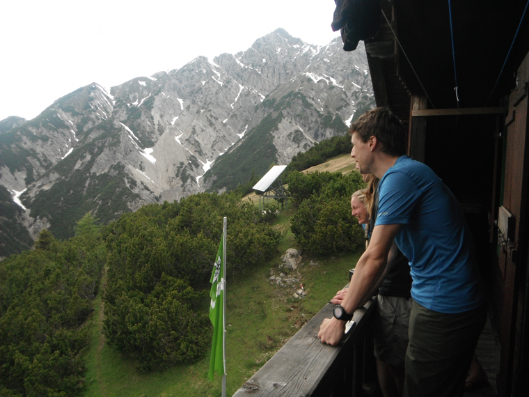
The view from Solsteinhaus
And then we see it: Solsteinhaus sat high above us between Erlspitze and Großersolstein peaks, our bed for the night. “Still looks quite a way off,” reckons Nicky, which is slightly worrying as the clouds are growing darker and thicker by the minute. But a herd of slightly aggressive sheep push us on towards Kuhlochspitze before we can give it much more thought. At last, a bit of flat hiking as we follow a scree gully below the Höllkar cirque, gravel spraying out from under our feet before one final push upwards. As the rain starts we see the red and white Austrian flag telling us we’ve made it to our base for the night. Just in time, too!
After a dinner of soup, schnitzel and wheat beer (thank God for that goods lift!) we head out behind the hut to look at tomorrow’s route. Our plan is to continue on the Adlerweg to Geißenbach, over the Eppzirler scharte, just below Erlspitze. The route looks… epic. Almost Lord of the Rings worthy: A switchback path over rock and scree to a notch in the cirque some 300m above us. But there’s one problem; it’s covered in snow. Fingers crossed it’ll melt overnight.
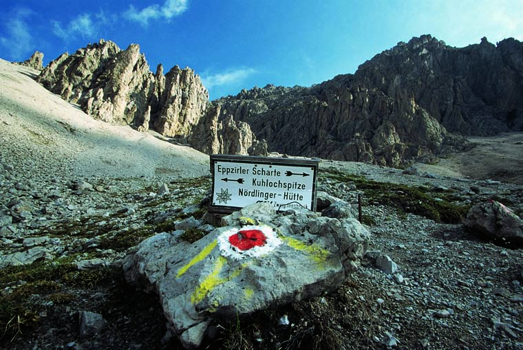
The route to Eppzirler Scharter in less snowy times | © Tirol Werbung
We raise early to more cloudy skies, and contemplate the Eppzirler scharte once more. The hut owner warns us of knee-deep snow and a very real danger of slides. “You should try the route towards Scharnitz – the Gleirschklamm is magical,” he suggests.
Within 10 minutes of leaving the hut, we’re grateful for the change in route. Even here large patches of snow remain, blocking our path in places, and the steep, gravelly route down the mountain towards Großkristental is challenging enough for first thing in the morning, with plenty of cliff-top paths, slippy scree and stream crossings to keep us on our toes.
Karwendel National Park|Tirol Werbung
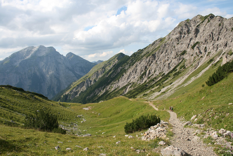
We’re well and truly in the Karwendel now, the largest range of the Northern Limestone Alps. It’s crazy to think that beyond the wall of mountains behind us lies the city of Innsbruck with all its cars, tower blocks and industry. Here it’s just quiet (albeit dramatic) valleys, pine trees, farms, alpine huts and the occasional fellow hiker. Even as the route flattens out and we reach another dirt track we see cyclists, but no cars and no houses. There’s not even sheep or cows clanging their bells, just streams filled with tadpoles and mountain lizards. The silence is mystifying.
The turning for the Gleirschklamm, a steep gorge which flows out into the river Isar, is marked by signs warning us it’s a walk for experienced hikers only. “How do you class experienced hikers, though?” ventures Alex. We decide to go for it, figuring we’re all sure-footed enough for any tough ledges.

It’s an immediate contrast to the 4WD track, starting with gloopy mud and constant ups and downs before reaching the gorge proper, where the path swaps between narrow ledges and wooden bridges. Sure-footed you certainly need to be; fall here and you will tumble into the roaring water 20 metres below.
But it’s hard to keep track of your feet with vistas like this. The steep ravine sides tower over you, carved out like a work of art and riddled with caves, archways and mini waterfalls. The river switches between bright blue and white water as it pummels over rocks and slides. Every twist and turn of the gorge opens up new intrigues and more ohhs and ahhs, not that we can hear them over the thunder of the water. We could not be happier that the snow forced us to divert this way.
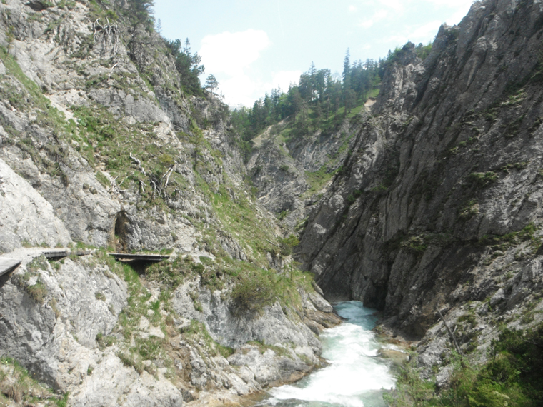
The Gleirschklamm
Thirty minutes after leaving the gorge – a return to forested roads, with glimpses of the river Isar below – we reach Scharnitzeralm, a proper cliche of a mountain hut complete with wood-clad walls, green shutters and flower-filled window boxes. We can’t resist pausing for a radler (shandy) before carrying along the Isar back to the hamlet of Geißenbach. From here, the Adlerweg carries on to Leutasch and then another 219km to the Tyrol’s farthest border. One day, I’ll hike all 24 stages of it. But for now it’s the train back to life, work and reality.

The obligatory end of walk shandy
DO IT
The Tyrol Tourist Board has streamlined the route for 2015, reducing it to 24 stages (each lasting roughly a day). If, like us, you don’t have time to hike all 320km of it, it’s easy to find a 2-3 day section which is well-connected at either end. Good options include St Johann to Kufstein, Pertisau to Innsbruck and Innsbruck to Leutasch. There’s also a further, unconnected nine-stage route in East Tyrol (separated from North Tyrol by Italy). The best time to hike it is June to September, when the risk of snow is greatly reduced.
GETTING THERE
Innsbruck is the best airport for accessing most stages of the hike, and is served by EasyJet from Gatwick thrice-weekly during summer. Munich and Salzburg are 2-4 hours from most points on the hike, but offer more choice in airlines and flights. Most sections are easily reached by trains and buses – visit oebb.at for times and prices.
STAYING THERE
The entire route is well served by mountain huts and refuges, with dorm rooms starting at about €18 per night. Membership to the Austrian Alpine Club (aacuk.org.uk) costs £46.50 yearly, and reduces prices to around €10 for the most basic option. Blankets and pillows are supplied, but bring your own sleeping bag liner.